Technology
Technology

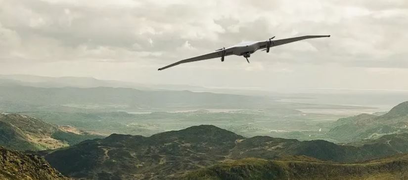
We collaborate with a reputable technical partner for military and non-military specifications UAV utilizing green energy fueled unmanned aerial vehicles aircraft.
Among the advantages and applications of the UAV:
Security
Border patrol
The use of UAV to meet the challenges of border protection is expanding. Firstly, it is cost-effective solution, and secondly – the most efficient in comparison with other means of patrolling. UAV is used extensively in border protection, has excellent performance characteristics, allowing to strengthen the control of even the most remote and inaccessible terrain.
Protection & Detection of Objects and People
UAV has become popular as “guards” – increase the level of security by monitoring the objects and people i.e. unauthorized intrusion of the oil and gas pipelines, mineral deposits, forests protection against possible fires and illegal logging, water bodies from pollution and illegal fishermen, power lines, city and intercity route during large-scale events.
Monitoring
Agriculture
Agriculture is one of the most promising areas whereby the usage of UAV is able to manage production efficiently. Ground-based studies have not always allow full analysis and assess of the conditions of agricultural land and control the process of planting and harvesting. The most cost-effective and efficient is the implementation of aerial and video using unmanned aerial vehicles.
Electricity Supply Grid
Air monitoring of power lines using UAV allows most effective evaluation of the technical condition of the wires and insulators to detect at any time of the day acts of unauthorized activity by unauthorized persons and vehicles in protected areas, to transmit real-time data quality defects wires during a power failure.
Land Resources
Air monitoring of land resources using UAV provides professionals with a unique opportunity to monitor changes in land resources. Images taken on board the UAV allows to evaluate, predict, and prevent potential disasters. UAV monitor land and forest resources in case of forest fire to detect fires in the early stages, conduct environmental monitoring, identify locations of landfills, and acts of unauthorized activity on the territory of nature reserves and historical and cultural monuments of nature.
Oil and Gas Pipelines
One of the most efficient and cost-effective method of survey oil and gas pipelines is the use of unmanned aerial vehicle (UAV). UAV in real time get high-quality images, allowing detection of oil spills, identify acts of unauthorized activity (landfills, frames, works in protected areas, etc.). Aerial photographs obtained from the UAV allow to analyze and evaluate the technical condition of pipelines and also serve as the basis for the creation of digital maps.
Forest Resources
UAV performs unmanned monitoring of forest resources and implement high quality survey. The results in the form of photos, videos, and infrared information, specialists will be able to do mapping of the area, including the definition of tree species, assess damage after forest fires or natural disasters. UAV is able to fly over even the most remote areas of the forest, discovering the unauthorized felling of forests and landfills, identifying the person and number of violators and machines, as well as to prevent forest fires through fire detection.
Water resources
The use of UAV is the most effective method for aerial monitoring of water resources at a considerable distance. Regular monitoring carried out by unmanned aerial vehicles allows monitorring and detection of illegal fishermen, as well as tsunami. Target loads with 20-fold optical zoom make it possible to most accurately determine the number of vessels and fishing nets to detect even underwater depending on water clarity.
Roads, Highways, & Rail Lines
For operational, maintenance, and analytical data on the state of Federal roads, highways, and rail lines with cost-effective use of UAV. UAV services provide information of road infrastructure i.e., assess the general state of the roads, conduct regular monitoring, control the work carried out, as well as during emergencies. UAV can monitor the road traffic situation in real time. In case of detection of offenders, UAV is able watch them automatically and recognize car license plates, make operational intelligence from the accident or disaster on the road site, thereby allowing managers to take as soon as possible management decisions.
Search & Rescue
Rescue Operations
UAV can be applied on search and rescue operations, including those lost in the forests or in distress in emergency situations. In carrying out rescue operations, UAV is the most reliable and secure source of information land groups. UAV reconnaissance operational conduct and a detailed examination of the terrain that allows mission manager to promptly assess the situation and make management decisions on the coordination of rescue teams.
Flood
UAV is the safest and most effective source of information in case of flood. UAV performs air monitoring area with video in real time, identify flood zones, determine the boundaries of spills, allow to coordinate the actions of search and rescue teams.
Talk to Our Experts
+606 794 1241
Download Our Brochure
Download (.pdf, 297kB)
Write to Us
sales@d-elektra.com

